


With 1.9.2 introducing calculus, some wild applications that earlier versions can only dream about are now possible.
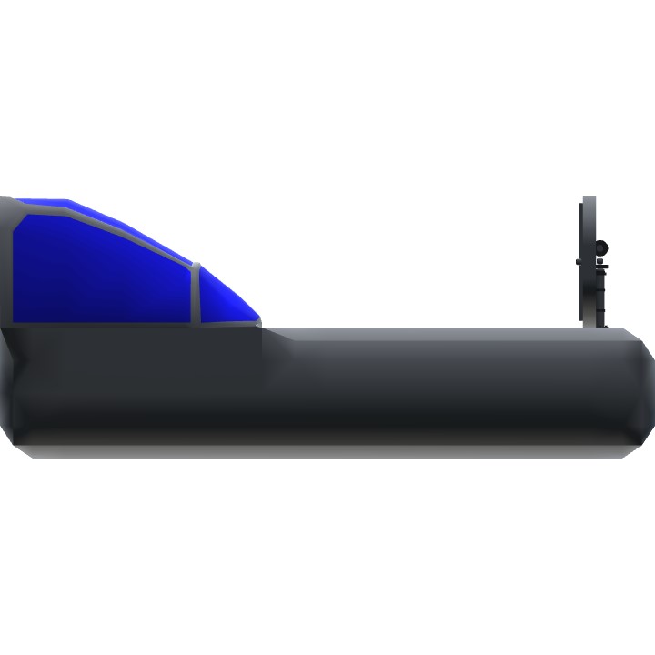
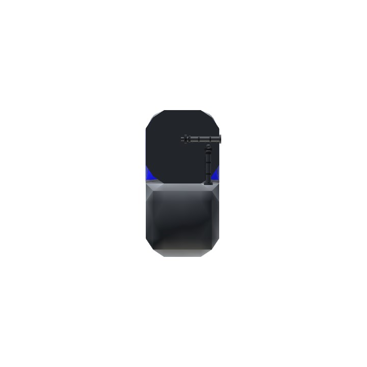
This is a prototype INS system I made with the new "sum" (i.e. integral) function. It shows your relative position from where you started. The system maxes out at 100 km to any direction, but supposedly getting out-of-bounds should not affect its accuracy.
If you have a XML modder, you can change the sensitivity of the map.
go to the input part, you should see:
clamp(GS * cos(PitchAngle blah blah blah..... / 10000, -1, 1)
Change that 10000 to any number you want. (10000 = 10000m = 100 km, the major game area is about 200 km south to north).
There are two pistons, one for North-South and one for West-East.
Since this thing uses pistons you need to be careful not to obstruct their collision model. submerging the whole system constantly in one fuselage block is fine (though it is advised that you turn off its collision model), just don't make the pistons and the blocks penetrate the boarder of a solid object.
I tested this with a supersonic jet and flew a combat sortie with it, I was expecting some error but it performs better than I thought. Flew from Kraklaboa to Snowstone and destroyed Ice Base, then returned, the INS was still spot-on.
Perhaps someone can try strapping this to a good plane and hunt the Brown Pearl with it. I think that was like 1000+km away from major playing area. If you are able to use this to fly back home after the battle, then I think we can be sure that this actually works.
Specifications
Spotlights
- MrSilverWolf 5.8 years ago
- MAINE 5.8 years ago
- FlyingHueman 5.8 years ago
General Characteristics
- Created On Windows
- Wingspan 1.7ft (0.5m)
- Length 8.2ft (2.5m)
- Height 3.3ft (1.0m)
- Empty Weight 675lbs (306kg)
- Loaded Weight 675lbs (306kg)
Performance
- Wing Loading N/A
- Wing Area 0.0ft2 (0.0m2)
- Drag Points 423
Parts
- Number of Parts 14
- Control Surfaces 0
- Performance Cost 47

@vcharng yeah
@MrSilverWolf If that's the case it would be easy to make, but real world VOR would usually require multiple VOR stations between the destinations...
@vcharng the station would be where you spawned I guess
@MrSilverWolf I am thinking about making a VOR, but setting the station position will be a problem...
There is a brown pearl?
With this, would it now be possible to make essentially IFR victor air routes and a ILS?
Ah shoot! I was just about to do this... Nice job.
As long as all bugs get fixed, the reference-point type system may be feasible with the
SelectedWeaponidentifier system.@vcharng Ah, I as usual didn't pay attention to the name :) Sorry about that.
Though, I think your efforts to show FT tech is a great feat and I hope more upvote because, upvoting it part of encouragement to build more and better things.
You do have talent so you deserve the recognition!
@sheepsblood Yes it IS a return home navigation. It only gives you your relative position from where you started. That's why it's an INS rather than a GPS.
In my future builds I may come up with an advanced version with map and configurable starting point (Avalanche airport, Yeager, Wright, etc) but right now this is nothing more than a technology demonstrator, to show everyone what the latest FT technology can do.
I believe it would work. You could place dots on the map and those will act as the points of interest. Though, the formula isn't quite complete. It needs to be able to triangulate where you are on the map and display that properly. Whenever I restart, it places the locator dot dead center. It is working more like a return to home from where you started rather than a radar or GPS.
I hope I helped and made it clear. I am not as brilliant as you with the calculus but, I figure if i help point out weaknesses that it will help you make this more spectacular than it already is.
Also, I changed the drag settings to false and 0 on every part, also no collisions for all parts, and set the pistons to not break. Because, when I tested it with my craft which is very heavy. It would snap apart.
Thanks for your build. Keep working on it!!!