
XYZ coord label (get map coordinates like longitude, latitude and altitude without console commands)
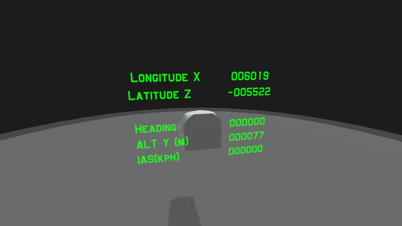
State-of-art XYZ coord label manufactured by ReyDeacon. Now you can get longitude, latitude, and altitude... on mobile! No PC console command required.
There's a rumor going around that this is a slightly modified version of a label that was stolen from Vertigo. ReyDeacon officially denies the truthfulness of such baseless rumor.
*Coords are displayed in meters. You can use them to get distance between points.
ReyDeacon is a renowned manufacturer of electronics and precision weapons, based somewhere in Main Jundland. Famous for Lawn Mower series strap-on precision laser guidance kits, as well as UMOR-N (Universal Multi-purpose Ordnance) PGMs.
Wright Airport map with coords, surveyed with a label similar to this. Took me a few good hours to record all these coords.

My forum post about this map
https://www.simpleplanes.com/Forums/View/1704843/Wright-Airport-Map-with-Detailed-Coordinates-for-autopilot-coding-and-stuff-Lon
Unfinished Yeager Airport map
Feel free to use


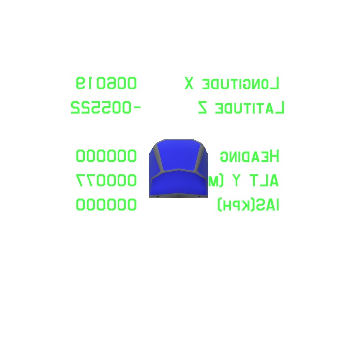
Cursed image of Wright Island. You've been cursed. WAHH!

Sponsored by ReyDeacon Epic Shade.
Specifications
General Characteristics
- Created On iOS
- Wingspan 9.8ft (3.0m)
- Length 3.3ft (1.0m)
- Height 7.8ft (2.4m)
- Empty Weight N/A
- Loaded Weight N/A
Performance
- Wing Loading N/A
- Wing Area 0.0ft2 (0.0m2)
- Drag Points 0
Parts
- Number of Parts 2
- Control Surfaces 0
- Performance Cost 31
@atgxtg
https://www.simpleplanes.com/a/1taUu8/Rotator-current-angle-demo-part-variable
Sorry it took a while, here's the thing. I took some inspiration from your option 1 and incorporated a rotating destination name thing (very James Bondian if you ask me, haha), as well as a simple text indicator.
I can't say for sure since I don't know how you'll do the pointing part of the thing, but if you use
ifargument ("A ? B : C" thing) like in the text indicator, I think you can do with just one set of the thing (that shows direction)@atgxtg
Oh, great! Will take a look at the page, thanks. (Gonna see if my brain can understand it... lol)
As for how to select destination from multiple options, I think using a rotator + 1 activationGroup might be the most economical solution, as it won't use too many AGs or other controls like Trim. The part has a variable called
Current Angle, which lets you get its current rotation (I think it ranges from -179 to 179).Let me get a quick demo build, I think it'll work pretty well for this.
@Kendog84
Actually the FT code for determining the heading and distance is the easy part. People do it in real life. check out: https://www.igismap.com/formula-to-find-bearing-or-heading-angle-between-two-points-latitude-longitude/
I probably take a stab at that later and use Wright Airport as a test.
To me, the hard bit would be selecting the destination. I can see a few ways to do it.
1) Each of the islands (and the Kraken/Cthulhu) could be it's own table, perhaps tied to an activation group. This would be easy, but lead to a lot of locations and clutter up the dash board.. Perhaps it could be put on some sort of rotating part (think revolving license plate) that use use a slider so as to only show one location and heading at a time.
2) The VTOL and Trim sliders could be the X and Y coordinates. Since the SP world takes up around a 200 mile by 200 mile area, we'd have to multiple the sliders and add the result to a centrally placed location. This means you could find the heading and distance to practically anywhere worth going to on the map, but in fairly large increments (about a mile per 0.01 difference on the sliders).
3) Somehow each locations and it's coordinated could be assigned to a position on the Trim slider. Something like Avalance, Krabola, Wright Island, and Maywar. I think it's possible to do that, but a bit beyond my current understanding.I might be able to program 3 locations to a slider. Maybe if I used a slider and an activation group I could get more.
Oh-wait, scratch the last sentence. It works differently from how I imagined it. Still a cool gizmo, though
(It doesn't use any fixed coords. It points to where you spawned at)
@atgxtg
That does sound cool, the navigation system. I would have to re-learn a lot of math to write FT for it (getting straight distance between you and any given island from XYZ coords, I have no idea how. I'm pretty sure it's possible though), but if I can figure out how this machine (link/"Homing Compass" by PilotOfFiture) works, I think I can do the 'point to island's direction' part with relative ease
@Kendog84
THe slow flying on autpilot thing is more when I'm testing a build to see if I got the fuel rate and range right. It's annoying to run out of fuel while island hopping.
As far as the circling thing goes, yeah, it seems possible. Basically it would have to check the coordinates to determine if the plane was within a certain distance from the island, and then initiate a slight bank and a bit of pitch to hold altitude. And then hope the plane doesn't fall into the sea or fly into a mountain, as there is nothing that prevents a plane of autopilot from doing either of those things.
What I think might be easier to implement and a bit more practical would be to select a destination (in SP, one of a handful of islands) and then the nav system displays the heading and distance to that destination. So if someone was in the ocean north of Wright Island and they wanted to go to Krakabloa it might show a bearing of 60 degrees and a distance of 20 miles/32km.
@atgxtg
That makes sense (and traveling in a slower plane sounds really nice, haha).
Hm... that gave me an idea. Some kind of toggle-able auto-pilot system that makes your plane fly in a circle when you are close to one of the islands. For when you want to point your plane to a general direction of a location, go AFK, but don't wanna waste time looking for the place when you come back.
I don't have the expertise to write code for it myself, but I do know it's possible. Might be a fun project to propose to people, haha
@Kendog84 Well getting lost depends a bit on what type of aircraft I flyy and how I
fly it. If I'm flying fast jets and fly near an island or fly from one to another, then I almost always know where I am. But if I am flying something slow like a small prop plane or autogyro that is going under 200 mph, then I might use more autopilot when going from one island to another and watch a video. At those time I might overshoot an island or undershoot it and not know quite where I am.
@atgxtg
Mmm, that makes sense. It's kinda cool that you can actually get lost like that. (I play on mobile, so there's no weather mod available)
You might find this useful too, in that case
Working GPS by IzzyIA
https://www.simpleplanes.com/a/8E3o28/GPS-Functional
Doesn't display coords, but lets you see which island is where.
@Kendog84
Yes, very useful. Sometimes I get lost between islands, especially when using weather effects.
@atgxtg
Glad you find it useful:) And thanks, gotta try that code.
This is nice, thanks. It can really help me figure out what direction to turn to when I get lost in the middle of the ocean. I just need to visit all the islands and get their general coordinates.
BTW, if you want an 360 degree heading instead of the +180 to -180 use {Heading<0? floor(Heading+360):floor(Heading)}
Yeah, I don't really know how label formatting works